Mount Washington State Park is home to a network in intertwined and interconnecting trails, but there are five primary trails used to day hike Mount Washington:
- Tuckerman Ravine Trail
- Lion Head Trail
- Boott Spur Trail
- Jewell Trail
- Ammonoosuc Trail
Each trail offers a slightly different hiking experience, both in terms of scenery and degree of difficulty. For an up-and-back hike, several options for combining multiple trails into a single day hike are also described below.
Tuckerman Ravine Trail and Lion Head Trail
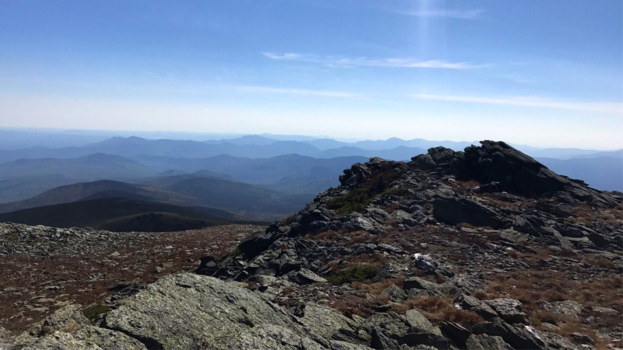
The two shortest popular routes up Mount Washington are Tuckerman Ravine Trail and Lion Head Trail. Both depart from Pinkham Notch, clock in at 4.2 miles one-way, and rise about 4,300 vertical feet. Lion Head Trail is steeper and more rugged than Tuckerman Ravine Trail so it tends to get less traffic, but it also offers better views during the slog up the mountain. Some day hikers make a loop by ascending on Lion Head (it is much easier to hike up a tough trail than down it) and descending via Tuckerman Ravine. Make no mistake, though: both trails are extremely strenuous, especially the climb up the headwall of the ravine and then the final push up to the summit cone.

Boott Spur Trail
The 5.4 mile Boott Spur Trail also approaches Mount Washington from the east but from the other side of the ravine. Although it is a little longer than Tuckerman Ravine and involves a few hundred feet greater gain in elevation to get to the spur itself, the trail itself is no more difficult, and the extra mileage is rewarded with a quicker route to break through treeline, resulting in better views throughout the hike, and much more solitude on the trail. A day hike loop can be made with Boott Spur Trail and either Tuckerman Ravine or Lion’s Head.
Jewell Trail
The easiest approach up Mount Washington is via the Jewell Trail. It begins in the parking lot of the Cog Railway station on Base Road. About 5.2 miles one-way, the trail gains “only” 4,000 feet of elevation and is generally more moderate than the other trails to the summit. Of course, moderate is a relative term; it is still an unrelenting, muscle-aching upward hike, involving giant steps up granite boulders for much of the route above tree line. But the views are amazing and continuous throughout the upper stretch, and watching the cog railroad train chugging up and down the mountain only adds to the memories of the hike.
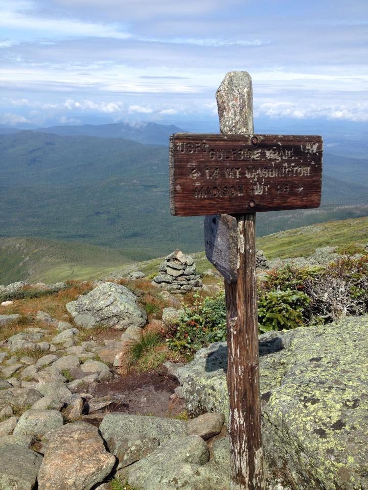
Ammonoosuc Ravine Trail
The Ammonoosuc Ravine Trail also departs from the Cog Railway parking lot, so a good loop hike ascends via the Ammonoosuc and returns on the Jewell. The Ammonoosuc is a little shorter than the Jewell Trail (4.5 miles one way) but considerably steeper and more rugged for a long section. For those wishing to visit the Lake of the Clouds AMC hut as part of your Mount Washington day hike, the Ammonoosuc Trail is the way to go.
Other Trails
Other trails that alone or in combination can be part of a Mount Washington day hike include the Great Gulf Trail, Huntington Ravine Trail, and the Nelson Crag Trail.
Trail Resources
- Best Trails in Mount Washington State Park – AllTrails
- Hike the Whites – Mt. Washington
Further reading on Mount Washington day hikes
Looking for more information about day hiking Mount Washington? Here are some pages to check out.
- Clothing and Equipment for a Mount Washington Day Hike
- Getting in Shape to Hike Mount Washington
- Preparing Mentally to Hike Mount Washington
- Safety Precautions Before Your Mount Washington Day Hike
- Frequently Asked Questions about Hiking Mount Washington
Learn about our annual Mount Washington HIKE for Mental Health
Interested in joining a great hike, for a great cause? Learn about HIKE for Mental Health's annual Summit Mount Washington day hike.
- Hike Mount Washington with HIKE for Mental Health
- Summit Mount Washington Smashes Goal
- Amazing photos and trail notes from our 2017 hike
- Painting the mountain orange: 2016 Summit Mount Washington photos
- Stunning views of 4th Annual Summit Mount Washington
- Spirits and Funds Reach New Heights on 3rd Annual Summit Mount Washington

It is possible to climb mont-washington by de Jewell Trail et come back by the Cog railway
Yes. If it is busy day on the Cog, you may have to wait to get a seat down, possibly until their last run, since they give priority to those who rode the Cog up, but they will get you down.
How much is the way down?
If you are asking about pricing for the COG railway, here is the link with up-to-date info. (https://www.thecog.com/). Is that what you needed?
They will not get you down if they are sold out of tickets. I wanted to purchase a ticket at the bottom for the way down only and I was told that I don’t need to buy a ticket yet and can buy on top. They also said that they get everyone down and they will even push extra people on. But after climbing to the top they said they are sold out and too bad.
We have heard some similar reports, but have also been told by staff that they will not strand someone on the top and will eventually get you down. You might have to wait for the last train of the day but they will get you down.
Hi,
Which trails are recommended if you’d like to hike up but take the Cog down so that you return to where your car is parked?
Katie, the Jewell trail leaves from the parking lot of the Cog. The Amonoosuc will also work with a little more walking.
I remember we hike up and Back down I don’t remember trail we hike because it was back in the late 70s when I was at eagleton school great berrington mass As a kid we got to see the inside where they can sleep if got stucK in snow storm it was just small place then bet it lot bigger now we had a great time too
I was wondering if it was too early to hike Washington the week of 4/27? What are the conditions of Tuckerman Ravine?
Hi Josh, because of the variability of the weather on Mt Washington, it is impossible to give you a definitive answer. I can tell you that the trail is closed right now – see the forest service bulletin: https://www.fs.usda.gov/alerts/whitemountain/alerts-notices/?aid=57640. Whether it will open by 4/27 depends on the weather. To stay on top of the situation, you can check current summit condition here: https://www.mountwashington.org/experience-the-weather/current-summit-conditions.aspx.
Sounds like ammo has some vertical scrambles or hiking on scary narrow ledges, which I’m too scared to do. Does jewel, lions head or tuckerman have these? Thank you
Hi Donna, I think the Jewel is the one for you. All the trails are a bit of a scramble or rock-hop near the summit, but the Jewel is definitely the most vertigo-friendly. It has a few steep moments on the final climb, but nothing that induce a fear of falling.
Hi Leo, I appreciate your comment that the Jewel has “NOTHING THAT INDUCE A FEAR OF FALLING”. I use to hike Huntington every year (pre-kids) and thought there were some scary spots on boulder faces but last weekend, the Ammonoosuc terrified me 10X more and I felt like I was gonna FALL OFF THE MOUNTAIN. I LOVE climbing Mt. Washington and waited 15 years for my kids to be old enough to hike it with me. It makes me so sad to think I’ll never be able to do it again. The physical challenge was energizing but the mental challenge was absolutely crippling. Is it true that the fear of falling is unlikely on the Jewel?
Hi Caron, in general, the Jewel Trail is steady upward March to the summit. All trails to the summit involve a steep rock-hopping scramble near the summit, so it’s impossible so there’s no chance someone with a severe fear of falling wouldn’t be triggered. But all the routes, it is the least likely induce that fear.
Hi – will Memorial Day weekend a good time to hike mt. Washington in terms of weather?
Because the weather on Mt Washington, especially on the summit, is so unpredictable, there isn’t a yes/no answer to that question. In general, the average summit temps in May-June vary from average lows around 30 degrees to averages highs in the upper 40s. On clear days with minimal wind, those temps can be good hiking. But heavy rain, sleet and snow are all possible, as they are any month of the year on Mt Washington. So watch the summit forecast closely and make sure you have the gear and skills manage the range of possible weather conditions whenever you go.
So if you want to assure a ride down, should you purchase a round trip ticket and only use the downside? Is that possible?
I wish I could give you a definitive answer. The challenge is that if you do not ride up, then technically they “may not have a seat available” for you on the way down. The priority is given to those who rode up. In practice, if you are willing to be patient about getting down, they will almost always find a way to get you on the train, although it sometimes does take some pleading.
How long does it take for the average person to reach the summit on the Jewell trail?
This is a common question but also a hard one to answer since there is no “average” person. Age, weight, physical conditioning, mental condition – these all factor in. The Jewell Trail is 5+ miles of steady uphill walking over uneven terrain and a some rock-hopping. If you are in good condition/stamina, take the amount of time it takes you to walk 5 miles on level ground and double it. Then add 30-40 minutes for rest stops. That’s as good an estimate as I can give you without more information. If you want to discuss further your personal situation/condition, just reach out via the Contact Us page and I’ll be happy to talk further with you about it.
Steve & Dee, avid hikers from Seattle, WA: Our attempt in Mid-July was robbed by the instant turn of weather half-way! Reached ‘shelter’ some 2 mls up on Turckerman Canyon/Lion’s head and the sun turned frosty. Ranger informed us about the hail/thunderstorm moving down and recommended BACK. With such solid ‘peakbagging’ experience as we have, we tried to move on any way. BUT, seeing the black sky at the top-though still dry- cautiously- we started back. Our story actually starts here: Got back into the car – drove around to the Auto Road and drove up to the summit. It was still dry with horrendous winds. Idea was to rock-hop and climb down to get to the point where we had left off. In less than 10 minutes, small walnut size hail started to pummel us. A whack of thunder/lightning hitting on the rocks as quickly climbed back up to safety. End of story. we were robbed by weather that Doppler or anything else failed to detect. Flew back to Seattle to do some of the Mount Rainier trails before first snow. NOTE: Some years back, we ascended Rainier via Camp Muir snowfield and Ingram Glacier overnight. So not fair about failed Mount Washington!